Pixxel Partners with SIIS to Bring Advanced Hyperspectral Satellite Data to Korea
Pixxel, the US-India-based space technology company pioneering hyperspectral satellite solutions, has taken a major step in expanding its global presence. On November 19, 2024, Pixxel signed a memorandum of understanding (MOU) with South Korea's SIIS Co., Ltd. (led by CEO Kim Moon-Gyu) during the Satellite Utilization Conference. This collaboration aims to supply hyperspectral satellite data to Korean industries, transforming the way satellite data is utilized across various sectors.
What Makes Pixxel’s Hyperspectral Data Unique?
Pixxel’s hyperspectral satellite technology is revolutionizing Earth observation. Unlike traditional multispectral data, which captures only a limited number of wavelengths, hyperspectral data collects detailed information across hundreds of narrow spectral bands. This enables unparalleled insights into the physical and chemical properties of Earth's surface and atmosphere. Industries can leverage this data for applications such as agriculture, climate change monitoring, natural resource management, and defense.
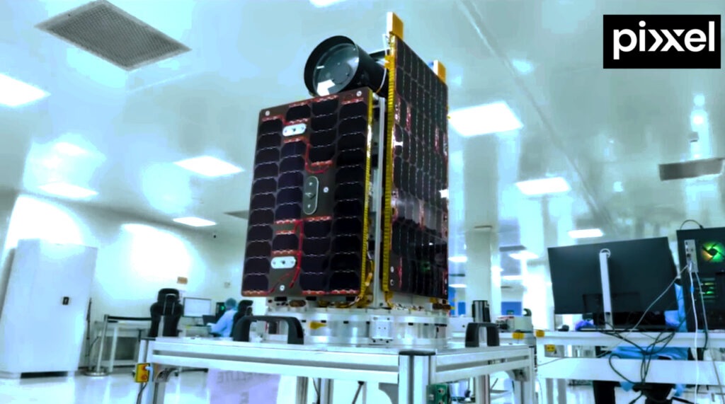
Pixxel’s upcoming hyperspectral constellation, named Fireflies, is set to launch in early 2025. The constellation will include six commercial-grade satellites capable of delivering:
- 5-meter spatial resolution
- 40-kilometer swath coverage
- Daily revisit capabilities
- Hundreds of spectral bands
These specifications make Pixxel’s satellites the most advanced in hyperspectral imaging, providing global industries with precise, high-fidelity data for actionable insights.
Strengthening SIIS’s Earth Observation Portfolio
For SIIS, the partnership with Pixxel signals a strategic expansion of its offerings. Currently specializing in optical and radar satellite imagery, SIIS plans to integrate Pixxel’s hyperspectral data into its portfolio. CEO Kim Moon-Gyu highlighted the importance of this collaboration, stating that it will enable SIIS to provide advanced insights to industries ranging from energy and agriculture to environment and defense.
SIIS is also preparing to launch SpaceEye-T, Korea’s first private Earth observation satellite, in March 2025. Developed with domestic investment and technology, SpaceEye-T will deliver 30cm-class ultra-high-resolution spatial information. This marks a significant milestone for SIIS as it seeks to compete with global leaders in the geospatial data market.
Bridging Technology and Market Demand
Pixxel’s hyperspectral imaging capabilities, combined with SIIS’s expertise in satellite data applications, create a powerful synergy. Awais Ahmed, Founder and CEO of Pixxel, emphasized that this partnership aligns with the company’s mission to build a "health monitor for the planet." SIIS will leverage its local expertise to educate Korean industries about the benefits of hyperspectral technology and facilitate its adoption in critical areas such as agriculture, environmental monitoring, and defense.
Pixxel’s Chief Commercial Officer, Aakash Parekh, praised SIIS as an ideal partner for entering the Korean market. “SIIS has built a high-caliber team with deep expertise,” Parekh said. “Together, we will enable Korean users to leverage the transformative benefits of hyperspectral technology, expanding its applications and solving complex challenges.”
A New Era of Satellite Data in Korea
The integration of Pixxel’s hyperspectral data with SIIS’s existing capabilities is expected to enhance Korea’s competitiveness in the global satellite data market. By combining ultra-high-resolution imagery with hyperspectral analysis, SIIS aims to meet diverse analytical demands and unlock new applications in Earth observation.
As Pixxel prepares to launch its Fireflies constellation and SIIS gears up for SpaceEye-T’s deployment, the collaboration signals the dawn of a new era in satellite data solutions. With their combined strengths, both companies are set to drive innovation, improve decision-making across industries, and redefine the possibilities of Earth observation technology.